


Arun Valley Trek Guide
The Arun Valley trek is a remote, low-altitude cultural journey through eastern Nepal's deep Arun river valley, one of the deepest valleys in the world, climbing from Tumlingtar and Khandbari through diverse Rai, Limbu and Sherpa villages toward the Makalu region foothills.
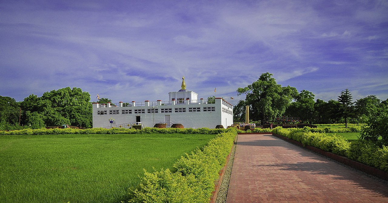
A glimpse of Arun Valley


Overview
The Arun Valley trek follows the course of the mighty Arun river through Sankhuwasabha district in the Koshi province of eastern Nepal, threading along one of the deepest river valleys in the world. The river cuts a vast trench between the high ranges, and the trail climbs steadily from the lowland warmth of Tumlingtar and Khandbari into cooler, forested hill country on the long approach toward the Makalu region. It is a classic walk-in trek of the kind that has grown rare as roads reach deeper into the hills, and it remains one of eastern Nepal's quietest and most culturally rewarding routes.
This is above all a cultural and scenic trek rather than a high-altitude one. The valley is home to a rich mix of peoples, including Rai, Limbu and Sherpa communities, whose villages, terraced fields and forest trails the route passes through day after day. You walk among rice and millet terraces in the lower valley, then through subtropical and rhododendron forest higher up, sleeping in basic teahouses and homestays and sharing the rhythm of farming life along the way.
Most trekkers complete the journey in 10 to 16 days depending on the chosen route, with a high point of around 3,000 m, low enough that altitude is rarely a serious concern. Access usually begins with a flight or long drive to Tumlingtar, the airstrip town in the valley, from where the trail climbs up through Khandbari and the hill villages beyond. Long approach days and limited facilities are part of the character here.
The Arun Valley sits at a crossroads of eastern Nepal's great trekking country. The upper valley feeds toward the Makalu Base Camp region and the high peaks of the Makalu-Barun area, while the trails of the Kanchenjunga region lie farther east. For those who value solitude, deep cultural immersion and lush, living landscapes over headline mountain views, the Arun Valley is one of Nepal's most rewarding off-the-beaten-path choices.
Day-by-Day Itinerary
This is a representative Arun Valley itinerary built around the classic walk-in from Tumlingtar and Khandbari into the hill villages toward the Makalu foothills. The exact route and length vary widely, from a shorter cultural loop of around 10 days to a longer traverse of 14-16 days that pushes deeper toward the Makalu-Barun region. It begins with a flight or drive to Tumlingtar from Kathmandu.
Day 1: Fly or drive Kathmandu to Tumlingtar (410 m)
A short flight from Kathmandu to the airstrip town of Tumlingtar in the Arun valley, or a long road journey east. Tumlingtar sits low and warm beside the river and is the gateway to the whole region. (Flight around 45 minutes, or a full day or more by road.)
Day 2: Tumlingtar to Khandbari (1,040 m)
A gentle climb out of the valley floor to the busy hill bazaar town of Khandbari, the district headquarters of Sankhuwasabha, with its shops, lodges and mix of hill peoples. A good place to stock up and settle into the walking. (4-5 hours.)
Day 3: Khandbari to Chichila (1,830 m)
The trail follows a ridge through farmland and the first stretches of forest, with widening views across the deep valley, to the Sherpa village of Chichila. The air begins to cool as you gain height. (5-6 hours.)
Day 4: Chichila to Num (1,560 m)
A walk through dense rhododendron and oak forest along the ridge before a long descent toward Num, a village perched high above a dramatic bend of the Arun. The forest here is rich and the scenery wild. (5-6 hours.)
Day 5: Num to Seduwa (1,500 m)
A steep descent to the Arun river and a suspension-bridge crossing, then a long climb up the far side to Seduwa, a village set among terraced fields. This is often the point where routes entering the Makalu-Barun National Park require their park permit. (6-7 hours.)
Day 6: Seduwa to Tashigaon (2,070 m)
A steady climb through farmland and forest to Tashigaon, the last permanent Sherpa village on the approach toward the higher Makalu country. Village life, gompas and mountain views fill the day. (4-5 hours.)
Day 7: Explore and acclimatise around the upper villages
A flexible day to rest, explore the upper villages and forest, and take in the surroundings. On a shorter Arun Valley trek this marks the high point of the route, at around 3,000 m on the ridges above, before the return.
Days 8-11: Return through the valley villages
The walk back retraces the high country and then branches through different Rai and Limbu villages and terraced hillsides on the descent toward Tumlingtar, with the deep Arun valley always below. Longer itineraries spend these days exploring side villages and forest trails. (5-7 hours per day.)
Day 12: Return to Tumlingtar and fly or drive to Kathmandu
A final descent to Tumlingtar and the flight or long road journey back to Kathmandu, completing the trek. Longer 14-16 day versions add further days deeper toward the Makalu foothills before returning. (Flight around 45 minutes.)
Difficulty & Fitness
The Arun Valley trek is graded moderate. Its challenge comes not from altitude, which stays low, but from the length of the route, the long approach days and the repeated steep descents to the river and climbs back up the far side.
- Low altitude. The high point is around 3,000 m, so serious altitude sickness is uncommon. This makes the trek accessible to walkers who want a long Himalayan-region journey without the risks of the high passes.
- Steep valley walls. The defining feature is the depth of the Arun valley. Days that cross the river involve long, knee-testing descents followed by sustained climbs, which are tiring even at modest height.
- Long route, basic facilities. With 10-16 days of walking through remote country, teahouses and homestays are simple and sparse, and supplies thin out away from the bazaar towns. Stamina and flexibility matter more than technical skill.
- Warm, humid lower valley. The lower trails can be hot and humid, especially in the shoulder months, which adds to the effort on the climbs.
You should be comfortable walking 5-7 hours a day for many days in a row on uneven hill trails with significant ups and downs. No technical mountaineering skills or prior high-altitude experience are needed, but a solid base of hill-walking fitness built up beforehand will make the long days far more enjoyable.
Permits & Regulations
The Arun Valley trek is not in a restricted area, so you do not normally need a special restricted-area permit. The documents you need are:
- TIMS card (Trekkers' Information Management System), around NPR 2,000 for foreign nationals, arranged through a registered trekking agency.
- Makalu-Barun National Park entry permit, around NPR 3,000 for foreign nationals, required only if your route climbs into the national park toward the Makalu region, typically from around Seduwa and beyond. A purely lower-valley cultural route may not enter the park, so whether you need this depends on the exact itinerary.
Since 2023, Nepal requires trekkers on organised treks to use a licensed guide rather than walking fully independently. Given how remote and lightly travelled the Arun Valley is, with limited signage and a thin scatter of homestays, almost everyone trekking here does so with a guide and a registered agency anyway. Carry your passport and several passport photos, keep permits handy for checkpoints, and, because rules and exact permit requirements for this less-regulated route can change, confirm the current requirements with a registered agency before you travel.
Cost & Budget
The Arun Valley trek is moderately priced for a long eastern Nepal journey. The main variables are the number of days and whether you fly or drive to Tumlingtar.
- Guided package: typically around USD 800-1,500 per person depending on group size and the number of days. This usually covers the guide, porter, permits, transport, accommodation and meals on the trek.
- Transport: a flight to Tumlingtar saves a great deal of time but adds cost, while the long drive east is cheaper but slow. The longer the route toward the Makalu foothills, the higher the overall price.
- Permits: a TIMS card (around NPR 2,000) plus, if your route enters it, the Makalu-Barun National Park entry permit (around NPR 3,000).
- On-trail spending: carry enough Nepali rupees in cash for the whole trek, as there are no ATMs in the hill villages, and budget for extras, homestay purchases and tips.
Smaller groups pay more per head, while larger groups spread the guide and transport costs and bring the price down. A generous tip for guides and porters is customary, and you should budget a small contingency for flight delays, slow roads or extra nights, all of which are common on a long remote trek.
Best Time to Trek
There are two clear trekking seasons for the Arun Valley, and because the lower valley is warm and humid, the choice between them shapes both comfort and views.
- Spring (March-May) brings warm days, blooming rhododendron forest on the higher ridges and generally settled weather. The lower valley can be hot by late spring, but the forest colour and clear mountain air make it a lovely season to walk.
- Autumn (October-November) offers the most stable weather and the clearest views after the monsoon has cleared the air, with firm trails and comfortable temperatures across most of the route. It is the most popular time for this trek.
Avoid the monsoon (June-early September): the deep valley becomes wet, the forest trails turn slippery and thick with leeches, river crossings can be hazardous, and landslides can block roads and paths. Deep winter (December-February) is cold on the higher ridges but the low-altitude valley remains walkable, though hazy. For the best balance of weather, views and comfort, plan for spring or autumn.
Packing, Safety & Tips
Acclimatisation
With a high point of around 3,000 m, altitude sickness is rarely a concern on the Arun Valley trek, which is one of its appeals. The greater physical demand comes from the long days and the steep descents and climbs across the deep valley. Pace yourself, stay hydrated, and watch for the effects of heat and humidity in the lower valley rather than altitude.
Gear & packing
Pack for a long trek that spans warm valley floor and cool forested ridges: lightweight layers for the hot lower trails, a warm fleece or down layer and a sleeping bag for the higher villages (homestay bedding is basic), sturdy broken-in boots, trekking poles for the long descents, sun protection and a headlamp. Bring a reliable water-purification method, snacks, and a first-aid kit with blister care. For the forest in shoulder seasons, pack leech protection and good waterproofs.
Communications & money
Phone signal is patchy across the valley and absent in the remoter and higher sections. There are no ATMs on the route once you leave the bazaar towns, so carry enough cash in Nepali rupees for the whole trek plus a buffer. Homestays and small lodges deal only in cash.
Safety & insurance
Buy comprehensive travel insurance that covers trekking and includes helicopter evacuation. Even though the altitude is low, the Arun Valley is genuinely remote, roads are distant, and a medical evacuation is far easier to arrange with cover in place. Trek with a licensed guide who knows the homestays and the lightly used, poorly signed trails, and take care on the steep river crossings and descents.
Combining with other treks
The Arun Valley is the natural approach to the high Makalu Base Camp region, and trekkers with more time often continue from the upper valley toward the Makalu-Barun country. Farther east lie the trails of the Kanchenjunga region and the long Lumba Sumba Pass, while a gentler eastern add-on is the tea-garden hill station of Ilam. Base yourself in Kathmandu before and after to arrange permits, flights and a guide.
Altitude Sickness (AMS) & Trek Safety
The Arun Valley trek tops out at 3,000 m. AMS is less likely than on the high passes, but it can affect anyone above 2,500 m, know the signs. This section covers how to recognise altitude sickness, prevent it, prepare physically, and stay insured, it is general guidance, not medical advice.
Recognise the symptoms
| Level | Signs | What to do |
|---|---|---|
| Mild AMS | Headache, nausea or loss of appetite, dizziness, fatigue, broken sleep. | Stop ascending, rest, hydrate. Do not go higher until symptoms clear; descend if they do not. |
| Severe, HAPE (lungs) | Breathlessness at rest, persistent cough, frothy or pink spit, chest tightness, blue lips. | Descend immediately and treat as a medical emergency, arrange evacuation. |
| Severe, HACE (brain) | Confusion, clumsiness or loss of balance, crushing headache, drowsiness, hallucinations. | Descend immediately, HACE is life-threatening within hours. Evacuate. |
Prevent it: the golden rules
- Ascend slowly. Above 3,000 m, raise your sleeping altitude by no more than ~300–500 m per day and take the built-in acclimatisation days.
- Climb high, sleep low. Day-hike higher, then come back down to sleep.
- Hydrate (3–4 litres/day), eat well, and avoid alcohol, sleeping pills and smoking at altitude.
- Never ascend with AMS symptoms, and descend at once if they worsen, going down is the only reliable cure.
- Consider acetazolamide (Diamox) as a preventive/treatment aid, but only after discussing it with your doctor.
Get trek-fit
Start training 6–8 weeks out: build aerobic base with running, cycling or brisk hill walking 3–4 times a week; add stair and hill repeats carrying a loaded daypack (6–8 kg) to ready your legs for long descents; and finish with a couple of back-to-back long hiking days to rehearse multi-day fatigue. Strong quads and good cardio make altitude far more manageable.
Insurance & evacuation
Buy travel insurance that explicitly covers trekking up to 3,000 m and helicopter evacuation, a rescue from altitude is essential and very expensive without cover. Carry your policy number and your operator’s emergency contact, and keep the booking details of any guide with you.
Frequently Asked Questions
How many days does the Arun Valley trek take?
The Arun Valley trek usually takes 10 to 16 days, depending on the route. A shorter cultural loop through the lower valley villages runs around 10 days, while a longer traverse that pushes deeper toward the Makalu foothills can take 14-16 days. The total includes the flight or long drive to and from Tumlingtar.
How hard is the Arun Valley trek?
It is graded moderate. The difficulty comes not from altitude, which stays around 3,000 m, but from the length of the route, the long approach days and the steep descents to the river and climbs back up the far side. A good base of hill-walking fitness and flexibility with basic facilities are important.
How high is the Arun Valley trek?
The high point is around 3,000 metres on the ridges above the valley, which is low by Himalayan standards. Much of the trek stays lower, in the deep Arun river valley and its hill villages, so serious altitude sickness is uncommon and the trek is accessible to those who want to avoid the high passes.
What permits do I need for the Arun Valley trek?
You need a TIMS card (around NPR 2,000 for foreigners). If your route enters the Makalu-Barun National Park toward the Makalu region, you also need its entry permit (around NPR 3,000). It is not a restricted area, so no special restricted-area permit is required, but since 2023 organised trekking requires a licensed guide. Confirm exact permits with a registered agency.
How much does the Arun Valley trek cost?
A guided package typically costs around USD 800-1,500 per person depending on group size and the number of days, usually covering guide, porter, permits, transport, lodging and meals. Whether you fly or drive to Tumlingtar affects the price. Smaller groups pay more per head, and you should carry extra cash, as there are no ATMs on the route.
What is the best time to do the Arun Valley trek?
The best times are spring (March-May), when the rhododendron forests bloom, and autumn (October-November), which offers the clearest views and the most stable weather. Avoid the monsoon for rain, leeches, landslides and difficult river crossings. The low-altitude valley remains walkable in winter, though hazy.
Do I need a guide for the Arun Valley trek?
Yes. Since 2023 Nepal has required a licensed guide for organised trekking, and the Arun Valley is remote and lightly travelled, with limited signage and few homestays, so almost everyone treks here with a guide and a registered agency. Confirm the current rules before you travel.
Where does the Arun Valley trek start?
It typically starts with a flight or long drive from Kathmandu to Tumlingtar, the airstrip town in the valley, from where the trail climbs through Khandbari and the hill villages beyond. The route follows the deep Arun river valley up toward the Makalu region foothills.
Why is the Arun Valley special?
The Arun river cuts one of the deepest river valleys in the world, between the high ranges of eastern Nepal. The trek is also notable for its cultural diversity, passing through Rai, Limbu and Sherpa villages, and for its lush forests and terraced farmland. It remains one of the quietest and most authentic routes in the country.
Is altitude sickness a risk on the Arun Valley trek?
The risk is low because the trek stays mostly in the valley and its hill country, with a high point of around 3,000 m. Most travellers feel no altitude effects at all. The bigger physical demands are heat and humidity in the lower valley and the long, steep descents and climbs across the deep valley.
What cultures will I encounter on the Arun Valley trek?
The Arun Valley is home to a rich mix of peoples, including Rai, Limbu and Sherpa communities. The trek passes through their villages, terraced fields and gompas, and you often sleep in family homestays and share meals, making it one of the most culturally immersive routes in eastern Nepal.
Can the Arun Valley trek be linked to Makalu Base Camp?
Yes. The upper Arun Valley is the classic approach to the Makalu Base Camp region, and trekkers with more time often continue from the upper villages toward the high Makalu-Barun country. This extends the trek considerably and adds real high-altitude walking, so plan extra days and permits accordingly.
Is the Arun Valley trek suitable for beginners?
It can suit fit beginners who want a long, low-altitude cultural trek over high passes, but the length, remoteness, basic facilities and steep valley terrain mean you should be comfortable walking many days in a row on demanding hill trails. A good base of fitness and a flexible, adventurous attitude help a great deal.
Compare with Other Nepal Treks
How Arun Valley stacks up against other popular Nepal treks, at a glance, to help you choose and plan.
| Trek | Difficulty | Max Altitude | Duration | Best Season | Region |
|---|---|---|---|---|---|
| Arun ValleyThis trek | 🟡 Moderate | 3,000 m | 10–16 days | Mar–May & Oct–Nov | Sankhuwasabha, Koshi |
| Makalu Base Camp | 🔴 Strenuous | 4,870 m | 18–22 days | Mar–May & Sep–Nov | Makalu-Barun, Koshi |
| Kanchenjunga Base Camp | 🔴 Strenuous | 5,140 m | 20–24 days | Mar–May & Sep–Nov | Taplejung, Koshi |
Why these grades?
Arun Valley 🟡 Moderate, A remote, low-altitude cultural trek through eastern Nepal's deep Arun valley, mostly below 3,000 m on long approach days through diverse villages and farmland; modest altitude but real remoteness and basic facilities.
Makalu Base Camp 🔴 Strenuous, Remote and rugged: it reaches 4,870 m via two high passes (Shipton La and Keke La), with long days, sparse basic teahouses and several nights above 4,000 m, best after a previous Himalayan trek.
Kanchenjunga Base Camp 🔴 Strenuous, A 20–24 day restricted-area expedition to 5,140 m at Pangpema, with very long remote days, basic or camping logistics and a high pass linking the north and south base camps, for experienced trekkers.
Reviews & Ratings
No reviews yet. Be the first to share your experience of Arun Valley!
By the BriefNepal Travel Desk
Researched and maintained by our Nepal-based editorial team and reviewed for accuracy. Last updated June 22, 2026. Prices, permits and conditions change, always verify before you travel. Spotted something out of date? Let us know.
Nepal Trip Planning Tools
Estimate your costs and trekking permits in seconds, built on real, current Nepali prices.
💰 Trip Cost Calculator
🎫 Trek Permit Calculator
Estimates only, fees and prices change with season and policy. Confirm with a registered agency and the Nepal Tourism Board before you travel.
Plan & Book Your Arun Valley Trip
Booking links may be affiliate partnerships, they help keep BriefNepal free and never change the price you pay.
Nepal Currency Converter
Live exchange rates for the Nepalese Rupee (NPR) against every world currency, handy for budgeting the prices in our guides.
Live mid-market rates. For information only, banks and exchanges apply their own margins.
Planning a trip to Nepal?
Join the BriefNepal Travel list for seasonal tips, new guides and our free Nepal trip-planning checklist. No spam, unsubscribe anytime.
Explore More of Nepal
Makalu Base CampA remote, wild trek to the foot of the world's fifth-highest peak. Kanchenjunga Base CampA remote trek to both base camps of the world's third-highest peak.
 Lumba Sumba PassA remote far-eastern crossing linking the Kanchenjunga and Makalu regions.
 IlamRolling tea gardens and misty green hills in the far east.