


Lower Dolpo Trek Guide
The Lower Dolpo trek is a remote, largely tented trans-Himalayan journey reached by flying to Juphal, taking in the turquoise Phoksundo Lake at 3,612 m and crossing the high Numa La and Baga La passes into the timeless Dho Tarap valley.
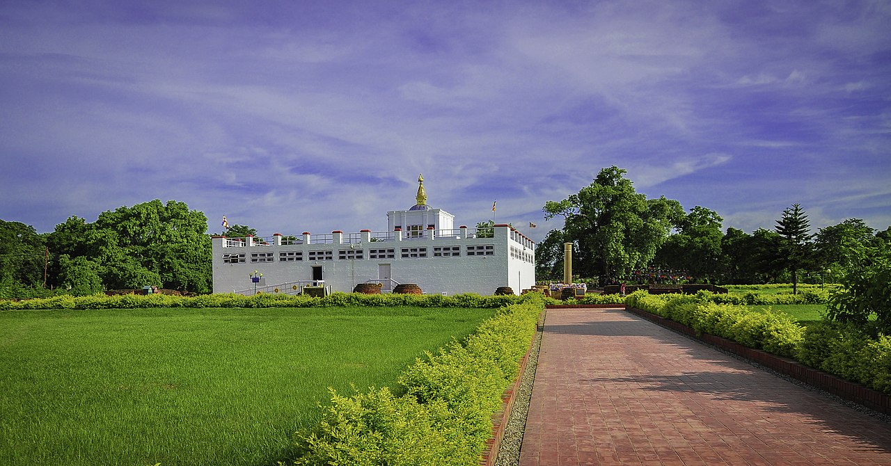
A glimpse of Lower Dolpo


Overview
The Lower Dolpo trek is one of Nepal's great wilderness journeys, a remote, demanding crossing of the trans-Himalayan country of Dolpa district in the far west of Karnali. This is a world apart from the busy Annapurna and Everest trails: a high, dry, sparsely populated land of deep gorges, blue lakes, ancient Bon and Buddhist culture, and some of the most isolated villages in the country. It shares its landscapes and spirit with the harder Upper Dolpo and the lake-focused Shey Phoksundo routes.
Access is by air. Most trekkers fly from Nepalgunj to the tiny airstrip at Juphal, then walk through Dunai, the district headquarters, before the trail begins its long climb into the high country. The first great highlight is the turquoise Phoksundo Lake (3,612 m), Nepal's deepest lake, set in the Shey Phoksundo National Park beneath dramatic cliffs and a waterfall, beside the Bon village of Ringmo.
From the lake, the route turns into serious high-mountain country, crossing the Numa La at around 5,190 m and the Baga La at around 5,070 m, two demanding passes that lead over the watershed into the remote Dho Tarap valley, one of the highest permanently inhabited valleys in the world. Here the culture is profoundly Tibetan, the villages are timeless, and the scenery is vast and austere.
Most parties complete the Lower Dolpo trek in 14 to 20 days, much of it camping, with food and gear carried by porters or pack animals. It is graded strenuous: the combination of serious altitude on the high passes, long days, isolation and the need for full tented logistics makes it a trek for experienced, well-prepared walkers seeking true Himalayan wilderness.
Day-by-Day Itinerary
This is a classic Lower Dolpo itinerary built around Phoksundo Lake and the crossing of the Numa La and Baga La into Dho Tarap. It is a largely tented trek, with food and gear carried by a support crew, and includes essential acclimatisation days. The trek begins and ends with flights via Nepalgunj to Juphal.
Day 1: Fly Nepalgunj to Juphal (2,475 m), trek to Dunai (2,140 m)
An early flight from Nepalgunj to the tiny airstrip at Juphal, then a descent and walk along the Thuli Bheri river to Dunai, the district headquarters of Dolpa. (2-3 hours walking.)
Day 2: Dunai to Chhepka (2,720 m)
Following the Phoksundo river upstream through a deepening gorge and forest, entering Shey Phoksundo National Park, to the settlement of Chhepka. (5-6 hours.)
Day 3: Chhepka to Chunuwar / Amchi (3,110 m)
A steady climb through pine and birch forest along the river, with the country growing wilder, to a camp around Chunuwar. (5-6 hours.)
Day 4: Chunuwar to Phoksundo Lake (3,612 m) via Ringmo
A climb past Nepal's highest waterfall to the Bon village of Ringmo and the turquoise shore of Phoksundo Lake, the scenic heart of the trek. (4-5 hours.)
Day 5: Acclimatisation and rest at Phoksundo Lake
An essential acclimatisation day to explore the lakeshore, visit the old Bon monastery and prepare for the high passes ahead. A vital rest before the altitude gain.
Day 6: Phoksundo Lake to Phoksundo Khola (3,630 m)
A traverse along a narrow trail above the lake, then a walk up the river valley to a camp in the meadows of the Phoksundo Khola. (4-5 hours.)
Day 7: Phoksundo Khola to Numa La Base Camp (4,440 m)
A long, steady climb up a side valley to a high camp below the Numa La, gaining significant altitude. (6-7 hours.)
Day 8: Cross Numa La (5,190 m) to Pelung Tang (4,465 m)
The first great pass: a demanding climb to the Numa La at around 5,190 m, the high point of the trek, with vast views including Dhaulagiri, then a descent to camp at Pelung Tang. (6-8 hours.)
Day 9: Cross Baga La (5,070 m) to Dajok Tang (4,080 m)
A second high crossing over the Baga La at around 5,070 m, then a long descent into more sheltered country towards Dho Tarap. (6-8 hours.)
Day 10: Dajok Tang to Dho Tarap (4,040 m)
A walk down into the remote, high Dho Tarap valley, one of the highest inhabited valleys in the world, with its Tibetan-Buddhist villages and monasteries. (4-5 hours.)
Day 11: Rest and explore Dho Tarap
A day to explore the villages, gompas and Bon and Buddhist culture of Dho Tarap, and to rest before the long descent out.
Day 12: Dho Tarap to Tarap Khola (3,800 m)
A descent following the Tarap Khola through a dramatic gorge, leaving the high valley behind. (6-7 hours.)
Day 13: Tarap Khola to Khanigaon (3,150 m)
Continuing down the gorge and river, with the landscape gradually lowering and greening, to camp near Khanigaon. (6-7 hours.)
Day 14: Khanigaon to Tarakot (2,540 m)
A final walk down the valley towards the Thuli Bheri and the village of Tarakot. (5-6 hours.)
Day 15: Tarakot to Dunai, then to Juphal
A walk back along the river to Dunai and up to Juphal in time for the return flight. (6-7 hours.)
Day 16: Fly Juphal to Nepalgunj
The morning flight out via Nepalgunj. Build in buffer days, as these remote flights are weather-dependent and frequently delayed, and longer itineraries add further rest and exploration days.
Difficulty & Fitness
The Lower Dolpo trek is graded strenuous and is a serious undertaking for experienced, well-prepared trekkers. It is far more demanding than the teahouse routes, with high passes, long days, remoteness and full tented logistics all adding to the challenge.
- Serious altitude. The high point is the Numa La at around 5,190 m, with the Baga La at around 5,070 m crossed soon after. Many days are spent at high altitude, so careful acclimatisation is essential.
- Long, hard days. The pass days involve 6-8 hours of demanding walking with big altitude gains and losses, on rough, often faint trails.
- Remoteness and isolation. Dolpo is one of the most isolated regions in Nepal. There are few villages, supplies are minimal, and medical help is far away, so self-sufficiency is vital.
- Tented logistics. Much of the trek is camping, with tents, food and gear carried by a support crew, which means a larger team and a more expedition-like experience.
You should be in strong physical condition, comfortable walking 6-8 hours a day for two to three weeks at high altitude on rough terrain. Previous high-altitude trekking experience is strongly recommended. This is a trek for those seeking genuine wilderness and cultural remoteness rather than comfort, and serious preparation makes all the difference.
Permits & Regulations
Lower Dolpo is a restricted area within a national park, so the permit rules are stricter than on the open trails, and you must trek through a registered agency with a licensed guide. The documents you need are:
- Lower Dolpo Restricted Area Permit, around USD 20 per week per person, required to enter the restricted zone beyond Phoksundo.
- Shey Phoksundo National Park entry permit, around NPR 3,000 for foreign nationals, since the route passes through the park and the lake.
- A licensed guide arranged through a registered agency is required to obtain the restricted-area permit and to trek here.
The restricted-area rule predates the wider 2023 change, but Nepal now also requires trekkers on organised treks to use a licensed guide generally, which is compulsory here in any case. Carry your passport and several passport photos, keep permits handy for the park and area checkpoints, and, because fees and rules for restricted areas can change, confirm the current requirements and exact costs with a registered agency before you travel.
Cost & Budget
Lower Dolpo is one of the more expensive treks in Nepal, mainly because of the remote flights, the tented logistics with a full support crew, and the restricted-area and park permits. Budgets vary with group size, duration and the level of support.
- Guided package: typically around USD 2,000-3,500 per person depending on group size and duration. This usually covers the permits, guide, cook and camp crew, porters or pack animals, flights, tents, food and full logistics.
- Permits: the Lower Dolpo restricted-area permit at around USD 20 per week, plus the Shey Phoksundo National Park entry permit at around NPR 3,000.
- Flights: the Nepalgunj-Juphal flights are a significant cost and are weather-dependent, so buffer days and possible re-bookings should be budgeted for.
- On-trail spending: there is effectively nowhere to spend money once you leave the roadhead, so the package and tips cover almost everything. Carry some cash for the towns and emergencies.
Because the trek requires a full camping setup, costs are higher than on teahouse routes, and smaller groups pay considerably more per head. A generous tip for the guide, cook and camp crew is customary, and you should budget a meaningful contingency for flight delays, extra days and the unpredictable logistics of a remote region.
Best Time to Trek
Lower Dolpo sits partly in the rain-shadow, but the high passes mean the trekking seasons are more constrained than in Mustang, and timing matters for snow on the Numa La and Baga La.
- Late spring (May-early June) is a good window, as the high passes are usually clear of deep snow and the weather is settling, with wildflowers in the meadows.
- Autumn (September-October) offers the most stable weather and the clearest views after the monsoon, and is the classic season for the high passes.
- Monsoon (mid-June-August) partly works in the rain-shadow inner valleys, and some operators run treks then, but the approach via the lower forest can be wet, leech-prone and prone to flight disruption.
Avoid deep winter (late November-March), when heavy snow closes the high passes and the cold at altitude is severe. Even in the best seasons, snow can linger on the Numa La and Baga La, so be prepared for cold, possible snow underfoot on the passes, and weather-related flight delays at Juphal in autumn or spring.
Packing, Safety & Tips
Acclimatisation
With a high point of around 5,190 m on the Numa La and many days at altitude, altitude sickness is a genuine risk. Build in the rest day at Phoksundo Lake and ascend the passes steadily, stay well hydrated, and watch closely for headache, nausea, breathlessness or worse signs. Descend without delay if symptoms worsen, the high, remote terrain makes prevention far better than cure.
Gear & packing
Pack for a high, cold, tented wilderness trek: a four-season sleeping bag, a warm insulated jacket, full layered clothing, windproof and waterproof shells, sturdy mountaineering-grade boots, gaiters, trekking poles, sunglasses and strong sun protection. Bring a reliable water-purification method, a comprehensive personal first-aid kit, and gear suited to camping in snow on the passes. Your agency provides tents and group equipment.
Communications & money
Phone signal is largely absent across Dolpo, and you should not rely on it. There are no ATMs once you leave the roadhead towns, so carry enough cash in Nepali rupees for tips, the towns and any emergencies. The trek is otherwise effectively cashless, as the package covers your needs.
Safety & insurance
Buy comprehensive travel insurance that covers trekking above 5,000 m and includes helicopter evacuation. This is essential here: Dolpo is extremely remote, medical help is days away on foot, and a rescue is only realistic with proper cover and the means to call it in. Trek with an experienced licensed guide and a registered agency, and respect the weather on the high passes.
Combining with other treks
Lower Dolpo is closely linked with the Shey Phoksundo trek, which shares the same lake and access, and is the natural step before the harder Upper Dolpo for those seeking the deepest wilderness. The turquoise lake itself is described under Phoksundo Lake. Trekkers drawn to remote far-western Nepal often pair a Dolpo journey with the Rara Lake trek. Arrange the full logistics through a registered agency well in advance.
Altitude Sickness (AMS) & Trek Safety
The Lower Dolpo trek climbs to 5,190 m, well into the zone where acute mountain sickness (AMS) is a serious, potentially fatal risk, careful acclimatisation is non-negotiable. This section covers how to recognise altitude sickness, prevent it, prepare physically, and stay insured, it is general guidance, not medical advice.
Recognise the symptoms
| Level | Signs | What to do |
|---|---|---|
| Mild AMS | Headache, nausea or loss of appetite, dizziness, fatigue, broken sleep. | Stop ascending, rest, hydrate. Do not go higher until symptoms clear; descend if they do not. |
| Severe, HAPE (lungs) | Breathlessness at rest, persistent cough, frothy or pink spit, chest tightness, blue lips. | Descend immediately and treat as a medical emergency, arrange evacuation. |
| Severe, HACE (brain) | Confusion, clumsiness or loss of balance, crushing headache, drowsiness, hallucinations. | Descend immediately, HACE is life-threatening within hours. Evacuate. |
Prevent it: the golden rules
- Ascend slowly. Above 3,000 m, raise your sleeping altitude by no more than ~300–500 m per day and take the built-in acclimatisation days.
- Climb high, sleep low. Day-hike higher, then come back down to sleep.
- Hydrate (3–4 litres/day), eat well, and avoid alcohol, sleeping pills and smoking at altitude.
- Never ascend with AMS symptoms, and descend at once if they worsen, going down is the only reliable cure.
- Consider acetazolamide (Diamox) as a preventive/treatment aid, but only after discussing it with your doctor.
Get trek-fit
Start training 6–8 weeks out: build aerobic base with running, cycling or brisk hill walking 3–4 times a week; add stair and hill repeats carrying a loaded daypack (6–8 kg) to ready your legs for long descents; and finish with a couple of back-to-back long hiking days to rehearse multi-day fatigue. Strong quads and good cardio make altitude far more manageable.
Insurance & evacuation
Buy travel insurance that explicitly covers trekking up to 5,190 m and helicopter evacuation, a rescue from altitude is essential and very expensive without cover. Carry your policy number and your operator’s emergency contact, and keep the booking details of any guide with you.
Frequently Asked Questions
How many days does the Lower Dolpo trek take?
The Lower Dolpo trek usually takes 14 to 20 days, including the flights via Nepalgunj to Juphal and essential acclimatisation days. The length reflects the remoteness, the high passes and the largely tented logistics, plus buffer days for the weather-dependent mountain flights.
How hard is the Lower Dolpo trek?
It is graded strenuous and is a serious undertaking. The high point is the Numa La at around 5,190 m, the days are long and the trails rough, the region is extremely remote, and most of the trek is camping with a support crew. Strong fitness and ideally prior high-altitude experience are recommended.
How high is the Lower Dolpo trek?
The high point is the Numa La at around 5,190 m, with the Baga La at around 5,070 m crossed soon after. The turquoise Phoksundo Lake sits at 3,612 m, and the remote Dho Tarap valley lies at around 4,040 m, so much of the trek is spent at significant altitude.
What permits do I need for the Lower Dolpo trek?
You need a Lower Dolpo restricted-area permit (around USD 20 per week) plus the Shey Phoksundo National Park entry permit (around NPR 3,000). A licensed guide arranged through a registered agency is required. As a restricted area it cannot be trekked independently. Confirm current fees with a registered agency.
How much does the Lower Dolpo trek cost?
A guided package typically costs around USD 2,000-3,500 per person depending on group size and duration, covering permits, guide, cook and camp crew, porters or pack animals, flights, tents, food and full logistics. The remote flights and tented support make it pricier than teahouse treks, and small groups pay more per head.
What is the best time to do the Lower Dolpo trek?
The best windows are late spring (May to early June) and autumn (September to October), when the high passes are usually clear of deep snow and the weather is most stable. The monsoon partly works in the rain-shadow inner valleys, but deep winter closes the high passes with snow and severe cold.
Do I need a guide for the Lower Dolpo trek?
Yes. As a restricted area, Lower Dolpo requires a licensed guide and a registered agency to obtain the permit and trek, and independent trekking is not permitted. The 2023 licensed-guide rule reinforces this. The remoteness and tented logistics make an experienced guide and crew essential in any case.
How do I get to the Lower Dolpo trek?
Access is by air. Most trekkers fly from Kathmandu to Nepalgunj, then take a small plane to the tiny airstrip at Juphal in Dolpa, and walk from there via Dunai. These mountain flights are weather-dependent and frequently delayed, so buffer days at each end are strongly advised.
Is the Lower Dolpo trek mostly camping?
Yes. Lower Dolpo is largely a tented trek, with tents, food and gear carried by porters or pack animals and prepared by a camp crew. Teahouses are minimal or absent on the high sections, so the trek has a more expedition-like character than the popular teahouse routes.
Is altitude sickness a risk on the Lower Dolpo trek?
Yes, it is a genuine risk, as the trek reaches around 5,190 m on the Numa La and spends many days at altitude. The rest day at Phoksundo Lake helps, but you must ascend the passes steadily, stay hydrated and watch for symptoms, descending without delay if they worsen, since the region is very remote.
What is Phoksundo Lake?
Phoksundo Lake, at 3,612 m, is Nepal's deepest lake, a strikingly turquoise body of water in Shey Phoksundo National Park beside the Bon village of Ringmo, beneath dramatic cliffs and the country's highest waterfall. It is the scenic highlight of the Lower Dolpo trek.
What is the Dho Tarap valley?
Dho Tarap, at around 4,040 m, is one of the highest permanently inhabited valleys in the world, reached over the Numa La and Baga La passes. Its villages are profoundly Tibetan-Buddhist, with monasteries and a timeless way of life, and it is the cultural heart of the Lower Dolpo trek.
Is the Lower Dolpo trek suitable for beginners?
No, it is not a beginner trek. The serious altitude on the high passes, long hard days, extreme remoteness and tented logistics make it suitable for fit, experienced trekkers, ideally with prior high-altitude experience. Beginners should build up on easier routes before attempting Dolpo.
Compare with Other Nepal Treks
How Lower Dolpo stacks up against other popular Nepal treks, at a glance, to help you choose and plan.
| Trek | Difficulty | Max Altitude | Duration | Best Season | Region |
|---|---|---|---|---|---|
| Lower DolpoThis trek | 🔴 Strenuous | 5,190 m | 14–20 days | May–Oct | Dolpa, Karnali |
| Shey Phoksundo | 🟠 Challenging | 3,612 m | 10–16 days | May–Oct | Dolpa, Karnali |
| Upper Dolpo | 🔴 Strenuous | 5,360 m | 21–28 days | May–Sep | Dolpa, Karnali |
Why these grades?
Lower Dolpo 🔴 Strenuous, A remote trek to Phoksundo Lake and over high passes such as the Numa La and Baga La around 5,190 m in the trans-Himalaya, largely camping with long committed days; serious altitude and isolation make it strenuous.
Shey Phoksundo 🟠 Challenging, A trek to Nepal's deepest lake, the turquoise Phoksundo at 3,612 m, through the Bon and Buddhist heartland of Dolpo; modest lake altitude but a remote, lightly served region, with higher options towards Shey Gompa.
Upper Dolpo 🔴 Strenuous, A committing 21–28 day restricted trek crossing several 5,000 m-plus passes in the arid trans-Himalaya, fully tented and extremely remote, among the most demanding journeys in Nepal.
Reviews & Ratings
No reviews yet. Be the first to share your experience of Lower Dolpo!
By the BriefNepal Travel Desk
Researched and maintained by our Nepal-based editorial team and reviewed for accuracy. Last updated June 22, 2026. Prices, permits and conditions change, always verify before you travel. Spotted something out of date? Let us know.
Nepal Trip Planning Tools
Estimate your costs and trekking permits in seconds, built on real, current Nepali prices.
💰 Trip Cost Calculator
🎫 Trek Permit Calculator
Estimates only, fees and prices change with season and policy. Confirm with a registered agency and the Nepal Tourism Board before you travel.
Plan & Book Your Lower Dolpo Trip
Booking links may be affiliate partnerships, they help keep BriefNepal free and never change the price you pay.
Nepal Currency Converter
Live exchange rates for the Nepalese Rupee (NPR) against every world currency, handy for budgeting the prices in our guides.
Live mid-market rates. For information only, banks and exchanges apply their own margins.
Planning a trip to Nepal?
Join the BriefNepal Travel list for seasonal tips, new guides and our free Nepal trip-planning checklist. No spam, unsubscribe anytime.
Explore More of Nepal
 Shey PhoksundoA trek to Nepal's deepest lake and the Bon heartland of Dolpo.Upper DolpoA restricted trans-Himalayan trek to Shey Phoksundo and ancient Bon villages.
 Rara Lake TrekA trek to Nepal's largest lake in the remote far-western Karnali.Phoksundo LakeNepal's deepest, turquoise alpine lake in remote Dolpo.