


Jomsom Muktinath Trek Guide
The Jomsom Muktinath trek is the classic Kali Gandaki pilgrim route, threading through the world's deepest gorge past Tatopani hot springs, Ghasa, Marpha and Kagbeni to the sacred temple of Muktinath at 3,760 m, holy to both Hindus and Buddhists.
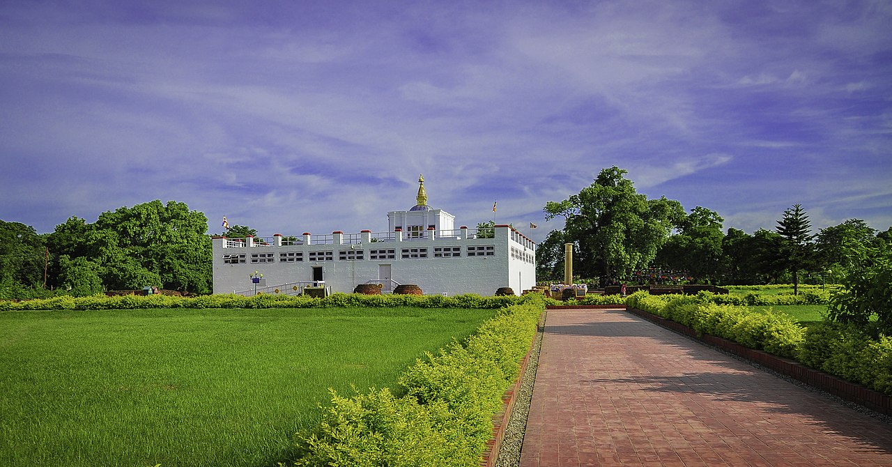
A glimpse of Jomsom Muktinath


Overview
The Jomsom Muktinath trek is one of Nepal's classic journeys, a pilgrim and trekking route that follows the Kali Gandaki through the deepest gorge on earth, between the towering 8,000-metre giants of Dhaulagiri and Annapurna, to the sacred temple of Muktinath (3,760 m) in Mustang district of Gandaki. It is a trek of dramatic contrasts, from subtropical lower valleys with hot springs and waterfalls to the dry, windswept, Tibetan-flavoured uplands of the rain-shadow, and it carries deep religious meaning for both Hindus and Buddhists.
The route is famous for the gorge itself, where the riverbed sits more than five kilometres below the surrounding peaks, making it by some measures the world's deepest. Along the way the trail passes the Tatopani hot springs, the village of Ghasa where the gorge is at its most spectacular, the immaculate apple town of Marpha, the regional hub of Jomsom (2,720 m), and the fortress-like village of Kagbeni, gateway to the restricted kingdom to the north.
The spiritual climax is Muktinath, one of the most revered pilgrimage sites in the Himalaya. Sacred to Hindus as a place of salvation and to Buddhists as a site of dakinis, its temple complex has 108 water spouts and an eternal natural flame, and it draws pilgrims from across South Asia. Reaching it on foot, after the long climb up the gorge, is the goal of the trek.
Most people complete the Jomsom Muktinath trek in 7 to 10 days, and the option to fly in or out of Jomsom makes it highly flexible. It is graded moderate, with well-developed teahouses and a road now running through much of the valley, making it one of the more accessible classic treks. Because it lies in the rain-shadow, it remains feasible even during the monsoon.
Day-by-Day Itinerary
This is a classic Jomsom Muktinath itinerary built around the climb up the Kali Gandaki to Muktinath. It can be shortened by flying in or out of Jomsom and using jeep transport on the road, or extended with extra village nights and the hot springs. The trek traditionally begins from a roadhead near Beni or Tatopani and ends at Jomsom, reached from Pokhara.
Day 1: Drive Pokhara to Tatopani (1,190 m)
A drive from Pokhara via Beni up the Kali Gandaki to Tatopani, famous for its riverside hot springs, where a soak makes a relaxing start. (4-5 hours by jeep.)
Day 2: Tatopani to Ghasa (2,010 m)
A climb up the deepening gorge, past waterfalls and through changing forest, into the spectacular heart of the Kali Gandaki to the village of Ghasa, where the gorge is at its most dramatic. (5-6 hours.)
Day 3: Ghasa to Marpha (2,670 m)

Continuing up the valley through Lete and Tukuche, with growing views of Dhaulagiri and the Nilgiri peaks, to the immaculate apple town of Marpha, famous for its orchards, apple brandy and stone-paved lanes. (6-7 hours.)
Day 4: Marpha to Kagbeni (2,810 m) via Jomsom

A walk up the wide, windy valley through the regional hub of Jomsom and on to the fortress-like village of Kagbeni, gateway to the restricted kingdom of Upper Mustang to the north. (5-6 hours.)
Day 5: Kagbeni to Muktinath (3,760 m)

A steady climb out of the Kali Gandaki up to the sacred site of Muktinath, passing villages and chortens with broad mountain views. The temple complex, with its 108 water spouts and eternal flame, is the spiritual climax of the trek. (5-6 hours.)
Day 6: Explore Muktinath, descend to Jomsom (2,720 m)

A morning at the Muktinath temple and the nearby village of Jharkot with its monastery, then a long descent back down the valley to Jomsom. (6-7 hours.)
Day 7: Fly or drive Jomsom to Pokhara
A short, scenic morning flight from Jomsom over the gorge to Pokhara, or a longer drive. Build in a buffer day, as Jomsom flights are weather-dependent and can be delayed.
Optional extension (1-3 extra days)
The trek can be lengthened with extra nights at Marpha or Muktinath, more walking sections rather than the road, or a side trip towards Lubra or the Lower Mustang villages, making a fuller 8-10 day journey.
Difficulty & Fitness
The Jomsom Muktinath trek is graded moderate and is one of the more accessible classic Himalayan treks, well within reach of reasonably fit walkers, including those tackling their first trek in Nepal. Good road and flight access and well-developed teahouses make it friendlier than the remote routes.
- Moderate altitude. The high point is Muktinath at 3,760 m. The gradual climb up the gorge usually allows comfortable acclimatisation, though the gain from the valley to Muktinath should still be taken steadily.
- Steady up-and-down walking. The route climbs continuously up the Kali Gandaki, with the climb to Muktinath the most strenuous section and long descents on the way down.
- Good infrastructure. Teahouses in Tatopani, Ghasa, Marpha, Jomsom, Kagbeni and Muktinath are comfortable and well established, and a road runs through much of the valley, giving flexible jeep options.
- Wind and dust. The upper Kali Gandaki valley is famous for its strong afternoon winds and dust, so walking is best done in the calmer mornings.
You should be comfortable walking 5-7 hours a day on valley trails, with one steeper day to Muktinath. No technical skills or previous high-altitude experience are required, though a base of regular hill walking beforehand will make the trek more enjoyable. It is a strong choice for those wanting a classic, culturally rich trek with relatively easy logistics.
Permits & Regulations
The Jomsom Muktinath trek follows the open, non-restricted lower and middle Kali Gandaki, so you do not need a restricted-area special permit. The documents you need are straightforward:
- Annapurna Conservation Area Permit (ACAP), around NPR 3,000 for foreign nationals, since the route lies within the conservation area.
- TIMS card (Trekkers' Information Management System), around NPR 2,000 for foreign nationals, arranged through a registered trekking agency.
The restricted-area boundary lies just north of Kagbeni, so you must not walk beyond it towards Upper Mustang without the costly special permit. Since 2023, Nepal requires trekkers on organised treks to use a licensed guide rather than walking fully independently, though this is among the more developed and accessible trekking regions. Carry your passport and several passport photos, keep permits handy for the ACAP checkpoints, and, because rules can change, confirm the current requirements with a registered agency before you travel.
Cost & Budget
Jomsom Muktinath is an affordable and flexible trek, since it avoids the expensive restricted-area permit and benefits from good road and flight access and well-developed teahouses. Budgets vary with group size, duration and whether you fly or drive.
- Guided package: typically around USD 600-1,200 per person depending on group size, the number of days and whether you include the Jomsom flight. This usually covers the guide, porter, permits, transport, accommodation and meals on the trek.
- Permits: ACAP at around NPR 3,000 plus a TIMS card at around NPR 2,000. No restricted-area permit is required.
- Transport: the drive to and from the roadhead, plus the optional scenic flight between Jomsom and Pokhara, which adds cost but saves a day and offers spectacular gorge views.
- On-trail spending: carry enough Nepali rupees in cash for the trek, as ATMs are limited to Jomsom and unreliable, for extras, hot springs, apple products in Marpha and tips.
Smaller groups pay more per head, while larger groups spread the guide and transport costs. Independent budget trekkers can keep costs at the lower end by using teahouses directly and walking sections, though a licensed guide is now the norm. Budget a small contingency for weather-related flight delays around Jomsom.
Best Time to Trek
The upper part of the Jomsom Muktinath route lies in the Himalayan rain-shadow, giving it a longer trekking window than most of Nepal, though the lower gorge near Tatopani is greener and wetter.
- Spring (March-May) brings warm days, blossoming orchards around Marpha and rhododendron in the lower forest, with generally clear mountain views. A beautiful and popular season.
- Monsoon (June-August) is feasible in the upper rain-shadow valley around Jomsom and Muktinath, though the lower gorge near Tatopani and Ghasa is wet and slippery in the monsoon. Many still trek the upper section then.
- Autumn (September-November) offers the most stable weather and the clearest views of Dhaulagiri and the Nilgiri peaks after the monsoon, and is the classic season for this trek.
Deep winter (December-February) is cold around Muktinath, with occasional snow at the higher elevations, though the lower and middle valley remains accessible. Strong afternoon winds and dust are a feature of the upper Kali Gandaki valley in almost any season, so plan to walk in the calmer mornings and carry sun and wind protection year-round.
Packing, Safety & Tips
Acclimatisation
With a high point of 3,760 m at Muktinath, altitude sickness is a modest but real consideration. The gradual climb up the gorge usually allows comfortable acclimatisation, but ascend steadily, stay hydrated in the dry upper air, and watch for headache, nausea or dizziness on the climb to Muktinath. If symptoms appear, rest or descend, which is easy on this valley route.
Gear & packing
Pack for a trek of contrasts, from warm lower valleys to cool, windy uplands: a warm sleeping bag or liner, a down or fleece layer, windproof and layered clothing, sturdy boots, trekking poles, strong sun protection, lip balm, a dust buff and a headlamp. Bring a reliable water-purification method, snacks, swimwear for the Tatopani hot springs, and a first-aid kit. The wind and evening chill can be sharp at Muktinath even in the warmer months.
Communications & money
Phone signal is reasonable in Jomsom and the main villages but patchier elsewhere. ATMs are limited to Jomsom and can be unreliable, so carry enough cash in Nepali rupees for the whole trek plus a buffer for extras, hot springs and tips. Lodges and shops deal mainly in cash.
Safety & insurance
Buy comprehensive travel insurance that covers trekking to your maximum altitude and includes helicopter evacuation, as even on this accessible route a serious problem in the high, dry valley is far easier to manage with cover in place. Trek with a licensed guide, build a buffer day for the weather-dependent Jomsom flight, and be prepared for strong afternoon winds and dust in the gorge.
Combining with other treks
Jomsom Muktinath shares its route with the open Lower Mustang trek, and the sacred Muktinath temple is its spiritual climax. It forms the western descent of the full Annapurna Circuit, which many combine with Tilicho Lake, and trekkers wanting to continue north can add the restricted Upper Mustang trek beyond Kagbeni. Base yourself in Pokhara before and after to arrange permits, transport and a guide.
Altitude Sickness (AMS) & Trek Safety
The Jomsom Muktinath trek reaches 3,760 m, high enough that acute mountain sickness (AMS) is a genuine risk for most trekkers, so acclimatise deliberately. This section covers how to recognise altitude sickness, prevent it, prepare physically, and stay insured, it is general guidance, not medical advice.
Recognise the symptoms
| Level | Signs | What to do |
|---|---|---|
| Mild AMS | Headache, nausea or loss of appetite, dizziness, fatigue, broken sleep. | Stop ascending, rest, hydrate. Do not go higher until symptoms clear; descend if they do not. |
| Severe, HAPE (lungs) | Breathlessness at rest, persistent cough, frothy or pink spit, chest tightness, blue lips. | Descend immediately and treat as a medical emergency, arrange evacuation. |
| Severe, HACE (brain) | Confusion, clumsiness or loss of balance, crushing headache, drowsiness, hallucinations. | Descend immediately, HACE is life-threatening within hours. Evacuate. |
Prevent it: the golden rules
- Ascend slowly. Above 3,000 m, raise your sleeping altitude by no more than ~300–500 m per day and take the built-in acclimatisation days.
- Climb high, sleep low. Day-hike higher, then come back down to sleep.
- Hydrate (3–4 litres/day), eat well, and avoid alcohol, sleeping pills and smoking at altitude.
- Never ascend with AMS symptoms, and descend at once if they worsen, going down is the only reliable cure.
- Consider acetazolamide (Diamox) as a preventive/treatment aid, but only after discussing it with your doctor.
Get trek-fit
Start training 6–8 weeks out: build aerobic base with running, cycling or brisk hill walking 3–4 times a week; add stair and hill repeats carrying a loaded daypack (6–8 kg) to ready your legs for long descents; and finish with a couple of back-to-back long hiking days to rehearse multi-day fatigue. Strong quads and good cardio make altitude far more manageable.
Insurance & evacuation
Buy travel insurance that explicitly covers trekking up to 3,760 m and helicopter evacuation, a rescue from altitude is essential and very expensive without cover. Carry your policy number and your operator’s emergency contact, and keep the booking details of any guide with you.
Frequently Asked Questions
How many days does the Jomsom Muktinath trek take?
The Jomsom Muktinath trek usually takes 7 to 10 days, including transport to the roadhead and the flight or drive back from Jomsom. Flying in or out and using jeep transport can shorten it, while adding extra village nights, the hot springs and more walking sections can extend it to a fuller week or more.
How hard is the Jomsom Muktinath trek?
It is graded moderate and is one of the more accessible classic treks, suitable for reasonably fit walkers and first-timers. The high point is Muktinath at 3,760 m, the gradual climb up the gorge aids acclimatisation, and good road access and teahouses make it less demanding than remote routes.
How high is the Jomsom Muktinath trek?
The high point is Muktinath at 3,760 m, the sacred temple that is the climax of the trek. The route starts low in the Kali Gandaki gorge around Tatopani (about 1,190 m) and climbs steadily through Marpha, Jomsom and Kagbeni up to Muktinath, so the altitude gain is gradual.
What permits do I need for the Jomsom Muktinath trek?
You need the Annapurna Conservation Area Permit (ACAP, around NPR 3,000) and a TIMS card (around NPR 2,000). The route is open and non-restricted, so no restricted-area permit is required, unlike Upper Mustang north of Kagbeni. Since 2023, organised trekking requires a licensed guide. Confirm current rules with a registered agency.
How much does the Jomsom Muktinath trek cost?
A guided package typically costs around USD 600-1,200 per person depending on group size, duration and whether the Jomsom flight is included, usually covering guide, porter, permits, transport, lodging and meals. It is affordable because it avoids the costly restricted-area permit, and smaller groups pay more per head.
What is the best time to do the Jomsom Muktinath trek?
Spring (March to May) and autumn (September to November) are the classic seasons, with warm days, blossoming orchards and clear views. The upper rain-shadow valley is feasible even in the monsoon, though the lower gorge is wet then. Winter is cold around Muktinath but the lower valley stays accessible.
Do I need a guide for the Jomsom Muktinath trek?
Since 2023 Nepal has required a licensed guide for organised trekking, so most trekkers walk Jomsom Muktinath with a guide and a registered agency, even though it is among the more developed and accessible regions. Confirm the current rules before you travel, as requirements can change.
What is special about Muktinath?
Muktinath, at 3,760 m, is one of the most sacred pilgrimage sites in the Himalaya, holy to both Hindus, as a place of salvation, and Buddhists. The temple complex has 108 water spouts and an eternal natural flame, and it draws pilgrims from across South Asia. It is the spiritual climax of the trek.
Can I fly to Jomsom for the trek?
Yes. There is a short, scenic flight between Pokhara and Jomsom over the Kali Gandaki gorge, and many trekkers fly in, out or both to save time. The flights are weather-dependent and frequently delayed, however, so it is wise to build in a buffer day around any Jomsom flight.
Is the Jomsom Muktinath trek really the world's deepest gorge?
The Kali Gandaki gorge that the trek follows is by some measures the deepest gorge on earth, since the riverbed sits more than five kilometres below the towering peaks of Dhaulagiri and Annapurna on either side. It is one of the trek's most dramatic features, especially around Ghasa.
Is altitude sickness a risk on the Jomsom Muktinath trek?
The risk is modest, as the high point is Muktinath at 3,760 m and the gradual climb up the gorge usually allows comfortable acclimatisation. Mild symptoms are still possible on the climb to Muktinath, so ascend steadily and stay hydrated. The valley route makes it easy to rest or descend if needed.
Are the Tatopani hot springs worth visiting?
Yes, many trekkers enjoy the riverside hot springs at Tatopani, whose name means hot water, as a relaxing start or finish to the trek. Bring swimwear and a towel. They are a pleasant way to soothe tired legs amid the dramatic lower Kali Gandaki scenery.
Compare with Other Nepal Treks
How Jomsom Muktinath stacks up against other popular Nepal treks, at a glance, to help you choose and plan.
| Trek | Difficulty | Max Altitude | Duration | Best Season | Region |
|---|---|---|---|---|---|
| Jomsom MuktinathThis trek | 🟡 Moderate | 3,760 m | 7–10 days | Mar–Nov | Mustang, Gandaki |
| Lower Mustang | 🟡 Moderate | 3,800 m | 5–8 days | Mar–Nov | Mustang, Gandaki |
| Annapurna Circuit | 🟠 Challenging | 5,416 m | 12–16 days | Mar–May & Oct–Nov | Annapurna, Gandaki |
Why these grades?
Jomsom Muktinath 🟡 Moderate, The classic Kali Gandaki pilgrim trek to the sacred temple of Muktinath at 3,760 m, with good lodges, road and flight access and moderate altitude; an accessible, culturally rich walk through the deepest gorge on earth.
Lower Mustang 🟡 Moderate, An open trek through the dramatic Kali Gandaki rain-shadow to Jomsom, Kagbeni and Muktinath at around 3,800 m, with good lodges, road access and moderate altitude; a scenic, accessible introduction to trans-Himalayan Mustang.
Annapurna Circuit 🟠 Challenging, Nepal’s classic circuit climbs the Marsyangdi valley to cross the 5,416 m Thorong La, the trek’s crux, before descending to Muktinath and the Kali Gandaki; good teahouses and a gradual ascent aid acclimatisation, so the high pass is the main challenge for fit trekkers.
Reviews & Ratings
No reviews yet. Be the first to share your experience of Jomsom Muktinath!
By the BriefNepal Travel Desk
Researched and maintained by our Nepal-based editorial team and reviewed for accuracy. Last updated June 22, 2026. Prices, permits and conditions change, always verify before you travel. Spotted something out of date? Let us know.
Nepal Trip Planning Tools
Estimate your costs and trekking permits in seconds, built on real, current Nepali prices.
💰 Trip Cost Calculator
🎫 Trek Permit Calculator
Estimates only, fees and prices change with season and policy. Confirm with a registered agency and the Nepal Tourism Board before you travel.
Plan & Book Your Jomsom Muktinath Trip
Booking links may be affiliate partnerships, they help keep BriefNepal free and never change the price you pay.
Nepal Currency Converter
Live exchange rates for the Nepalese Rupee (NPR) against every world currency, handy for budgeting the prices in our guides.
Live mid-market rates. For information only, banks and exchanges apply their own margins.
Planning a trip to Nepal?
Join the BriefNepal Travel list for seasonal tips, new guides and our free Nepal trip-planning checklist. No spam, unsubscribe anytime.
Explore More of Nepal
 Lower MustangJomsom, Kagbeni and Muktinath in the dramatic Kali Gandaki rain-shadow.
 Annapurna CircuitThe classic Himalayan circuit over the Thorong La to Muktinath.
 Tilicho LakeA side-trip off the Annapurna Circuit to one of the world's highest lakes, at 4,919 m.
 Upper MustangA restricted trek to the walled city of Lo Manthang in the old Forbidden Kingdom.